


We deal with a variety of navigational aids.
GPS (Global Position System) uses global orbiting satellites to calculate your ship’s position, heading, and speed. Your GPS accuracy can be greatly improved by using differential corrections with DGPS.
DGPS uses land based transmitters to send corrections to your DGPS receiver, thus cancelling out most natural and man-made errors. DGPS accuracy is +/- 3 meters.
WAAS GPS uses satellites to send corrections to your DGPS receiver. Instead of land-based transmitters with the accuracy of standard DGPS.
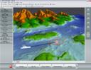
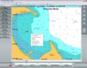
Electronic Chart Plotters are navigation tools that interface with GPS/DGPS receivers to show your ships position on a digitized NOAA Chart.
Digitized Charts, including Navionic, C-Map, NOAA/BSB Raster Charts.
Contact us to learn more about the variety of quality products and services we offer.